
Topografische Karte Aberdeen
Interaktive Karte
Klicken Sie auf die Karte, um die Höhe anzuzeigen.
Über diese Karte
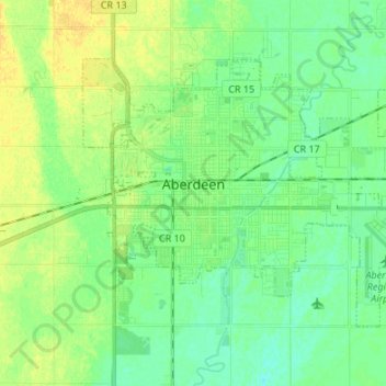
Name: Topografische Karte Aberdeen, Höhe, Relief.
Ort: Aberdeen, Brown County, South Dakota, 57401, United States (45.43008 -98.52648 45.49562 -98.39220)
Durchschnittliche Höhe: 399 m
Minimale Höhe: 390 m
Maximale Höhe: 411 m
Andere topografische Karten
Klicken Sie auf eine Karte, um ihre Topografie, ihre Höhe und ihr Relief anzuzeigen.
Westport
United States > South Dakota > Brown County
Westport, Westport Township, Brown County, South Dakota, United States
Durchschnittliche Höhe: 413 m
Mansfield
United States > South Dakota > Brown County
Mansfield, Brown County, South Dakota, 57460, United States
Durchschnittliche Höhe: 394 m
Groton
United States > South Dakota > Brown County
Groton, Brown County, South Dakota, 57445, United States
Durchschnittliche Höhe: 397 m
Moccasin Creek
United States > South Dakota > Brown County
Moccasin Creek, Brown County, South Dakota, United States
Durchschnittliche Höhe: 398 m
Groton City Limit
United States > South Dakota > Brown County > Groton City Limit
Groton City Limit, Brown County, South Dakota, United States
Durchschnittliche Höhe: 398 m
Aberdeen
United States > South Dakota > Brown County > Aberdeen
Aberdeen, Brown County, South Dakota, 57401-7699, United States
Durchschnittliche Höhe: 406 m