
Topografische Karte Mount Sunflower
Interaktive Karte
Klicken Sie auf die Karte, um die Höhe anzuzeigen.
Über diese Karte
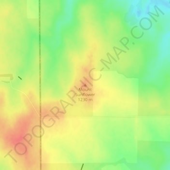
Name: Topografische Karte Mount Sunflower, Höhe, Relief.
Ort: Mount Sunflower, Wallace County, Kansas, United States (39.02188 -102.03730 39.02198 -102.03720)
Durchschnittliche Höhe: 1.215 m
Minimale Höhe: 1.186 m
Maximale Höhe: 1.239 m
Mount Sunflower, although not a true mountain, is the highest natural point in the U.S. state of Kansas. At 4,039 feet (1,231 m), it is 3,300 feet (1,010 m) above the state's topographic low point, which lies on the opposite side of the state. It is located between the communities of Kanorado and Weskan in Wallace County, less than half a mile (0.8 km) from the state border with Colorado and is close to the lowest point in Colorado.