
Topografische Karte Siruguppa
Interaktive Karte
Klicken Sie auf die Karte, um die Höhe anzuzeigen.
Über diese Karte
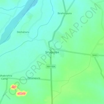
Name: Topografische Karte Siruguppa, Höhe, Relief.
Durchschnittliche Höhe: 372 m
Minimale Höhe: 346 m
Maximale Höhe: 470 m
Siruguppa is located at 15°38′N 76°54′E / 15.63°N 76.9°E / 15.63; 76.9. Located on the Deccan plateau, it has an average elevation of 373 metres (1223 feet). It belongs to the dry inland region of Karnataka with an annual rainfall of 645 mm. The Taluk is bounded in the south by Bellary taluk, in the west by Hospet taluk, in the north by Sindhanur taluk of Raichur district and in the east by Adoni taluk of Kurnool district of Andhra Pradesh.
Andere topografische Karten
Klicken Sie auf eine Karte, um ihre Topografie, ihre Höhe und ihr Relief anzuzeigen.
Konchigeri
India > Karnataka > Siruguppa taluku
Konchigeri, Siruguppa taluku, Ballari District, Karnataka, 583120, India
Durchschnittliche Höhe: 421 m
Karchiganuru
India > Karnataka > Siruguppa taluku
Karchiganuru, Siruguppa taluku, Ballari District, Karnataka, India
Durchschnittliche Höhe: 366 m