
Topografische Karte Chad Lake
Interaktive Karte
Klicken Sie auf die Karte, um die Höhe anzuzeigen.
Über diese Karte
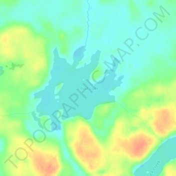
Name: Topografische Karte Chad Lake, Höhe, Relief.
Ort: Chad Lake, Saint Louis County, Minnesota, USA (47.96637 -92.23489 47.97939 -92.21421)
Durchschnittliche Höhe: 441 m
Minimale Höhe: 426 m
Maximale Höhe: 466 m
Andere topografische Karten
Klicken Sie auf eine Karte, um ihre Topografie, ihre Höhe und ihr Relief anzuzeigen.
Lake of the Woods County
Lake of the Woods County, Minnesota, USA
Durchschnittliche Höhe: 343 m
Alexandria
USA > Minnesota > Alexandria
Alexandria, Douglas County, Minnesota, 56308, USA
Durchschnittliche Höhe: 426 m
Wenonah
USA > Minnesota > Minneapolis
Wenonah, Minneapolis, Hennepin County, Minnesota, USA
Durchschnittliche Höhe: 255 m