
Topografische Karte Mount Pleasant
Interaktive Karte
Klicken Sie auf die Karte, um die Höhe anzuzeigen.
Mount Pleasant
The Mount Pleasant Municipal Airport (FAA Identifier: MPZ) is at an elevation of 730 ft (222.5 m) and is located 3 miles (4.8 km) southeast of the city. The airport started operations in March 1945. As of May 2014[ref] it has 2 runways: Runway 15/33 is hard surfaced (asphalt) and is 4001 ft long × 75 ft wide (1220 m × 23 m) with runway edge lights; Runway 03/21 is turf and is 1965 ft long × 120 ft wide (599 m × 37 m) marked by yellow cones.[20]
Über diese Karte
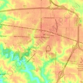
Name: Topografische Karte Mount Pleasant, Höhe, Relief.
Ort: Mount Pleasant, Henry County, Iowa, 52641, United States (40.93749 -91.59095 40.98853 -91.50619)
Durchschnittliche Höhe: 215 m
Minimale Höhe: 183 m
Maximale Höhe: 229 m