
Topografische Karte Bickerton Hill
Interaktive Karte
Klicken Sie auf die Karte, um die Höhe anzuzeigen.
Über diese Karte
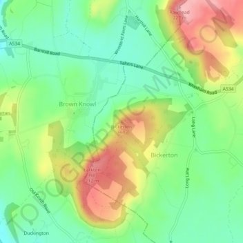
Name: Topografische Karte Bickerton Hill, Höhe, Relief.
Durchschnittliche Höhe: 134 m
Minimale Höhe: 77 m
Maximale Höhe: 221 m
Bickerton Hill refers to two low red sandstone hills that form the southern end of the Mid Cheshire Ridge in Cheshire, north-west England. The high point, Raw Head, lies on the northerly hill and has an elevation of 227 metres. Parts of the southerly hill are also known as Larkton Hill.