
Topografische Karte Wolcott
Interaktive Karte
Klicken Sie auf die Karte, um die Höhe anzuzeigen.
Über diese Karte
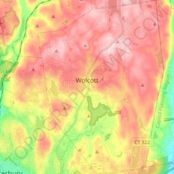
Name: Topografische Karte Wolcott, Höhe, Relief.
Ort: Wolcott, New Haven County, Connecticut, 06716, United States (41.55335 -73.02147 41.64433 -72.93318)
Durchschnittliche Höhe: 209 m
Minimale Höhe: 56 m
Maximale Höhe: 320 m
The highest point in New Haven County is found in Wolcott atop Lindsley Hill, which has an elevation of approximately 1,046 feet above sea level.