
Topografische Karte Mayhill
Interaktive Karte
Klicken Sie auf die Karte, um die Höhe anzuzeigen.
Über diese Karte
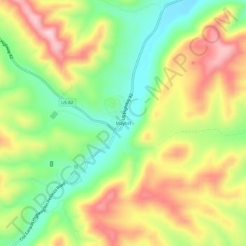
Name: Topografische Karte Mayhill, Höhe, Relief.
Ort: Mayhill, Otero County, New Mexico, United States (32.86954 -105.49804 32.90954 -105.45804)
Durchschnittliche Höhe: 2.104 m
Minimale Höhe: 1.974 m
Maximale Höhe: 2.255 m
Andere topografische Karten
Klicken Sie auf eine Karte, um ihre Topografie, ihre Höhe und ihr Relief anzuzeigen.
Alamogordo
United States > New Mexico > Otero County > Alamogordo
Alamogordo, Otero County, New Mexico, 88310, United States
Durchschnittliche Höhe: 1.716 m
Cloudcroft
United States > New Mexico > Otero County
Cloudcroft, Otero County, New Mexico, United States
Durchschnittliche Höhe: 2.643 m