
Topografische Karte Burj Umar Idris
Interaktive Karte
Klicken Sie auf die Karte, um die Höhe anzuzeigen.
Über diese Karte
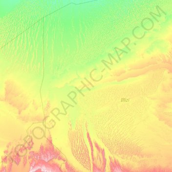
Name: Topografische Karte Burj Umar Idris, Höhe, Relief.
Ort: Burj Umar Idris, In Amenas District, Illizi, 33003, Algeria (26.26393 5.63844 30.14219 8.93103)
Durchschnittliche Höhe: 440 m
Minimale Höhe: 214 m
Maximale Höhe: 1.508 m
Bordj Omar Driss lies at an elevation of 354 metres (1,161 ft) at the south-western end of the Hamada de Tinrhert Desert, a vast rocky region of the Sahara Desert that extends eastwards into Libya. To the south of the town is an area of sand dunes, beyond which lies the mountain range Djebel Essaoui Mellene, an extension of the Tassili n'Ajjer range.