
Topografische Karte Rowland
Interaktive Karte
Klicken Sie auf die Karte, um die Höhe anzuzeigen.
Über diese Karte
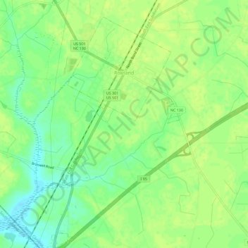
Name: Topografische Karte Rowland, Höhe, Relief.
Ort: Rowland, Robeson County, North Carolina, United States (34.50372 -79.30795 34.55009 -79.27885)
Durchschnittliche Höhe: 45 m
Minimale Höhe: 35 m
Maximale Höhe: 49 m
Andere topografische Karten
Klicken Sie auf eine Karte, um ihre Topografie, ihre Höhe und ihr Relief anzuzeigen.
Lumber Bridge
United States > North Carolina > Robeson County
Lumber Bridge, Robeson County, North Carolina, 28357, United States
Durchschnittliche Höhe: 59 m
McDonald
United States > North Carolina > Robeson County
McDonald, Robeson County, North Carolina, United States
Durchschnittliche Höhe: 46 m
Prospect
United States > North Carolina > Robeson County > Prospect
Prospect, Robeson County, North Carolina, United States
Durchschnittliche Höhe: 59 m
Alma
United States > North Carolina > Robeson County
Alma, Robeson County, North Carolina, 28364, United States
Durchschnittliche Höhe: 57 m
Pembroke
United States > North Carolina > Robeson County
Pembroke, Robeson County, North Carolina, 27372, United States
Durchschnittliche Höhe: 51 m
Lumberton
United States > North Carolina > Robeson County > Lumberton > Lumberton
Lumberton, Robeson County, North Carolina, 28359, United States
Durchschnittliche Höhe: 41 m
Phil
United States > North Carolina > Robeson County
Phil, Robeson County, North Carolina, United States
Durchschnittliche Höhe: 61 m
Lumberton
United States > North Carolina > Robeson County
Lumberton, Robeson County, North Carolina, United States
Durchschnittliche Höhe: 42 m
Maxton
United States > North Carolina > Robeson County
Maxton, Robeson County, North Carolina, United States
Durchschnittliche Höhe: 58 m