

Topografische Karte Tonalá
Klicken Sie auf die Karte, um die Höhe anzuzeigen.
Tonalá
The municipality is located in the eastern part of the state. With an average altitude of 1.500 meters above sea level, the territory has three kinds of relief: areas of rugged terrain, semi flat and flat areas. The main elevations are the Cerro Cúpula de la Reina, and Xólotl, both 1,720 meters above sea level.
Über diese Karte
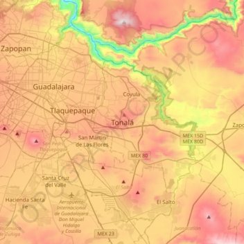
Name: Topografische Karte Tonalá, Höhe, Relief.
Ort: Tonalá, Región Centro, Jalisco, 45400, Mexico (20.46414 -103.40213 20.78414 -103.08213)
Durchschnittliche Höhe: 1.547 m
Minimale Höhe: 956 m
Maximale Höhe: 2.061 m