
Topografische Karte Tyson
Interaktive Karte
Klicken Sie auf die Karte, um die Höhe anzuzeigen.
Über diese Karte
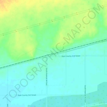
Name: Topografische Karte Tyson, Höhe, Relief.
Ort: Tyson, Yuma County, Arizona, United States (32.77671 -113.90160 32.81671 -113.86160)
Durchschnittliche Höhe: 94 m
Minimale Höhe: 83 m
Maximale Höhe: 113 m
Andere topografische Karten
Klicken Sie auf eine Karte, um ihre Topografie, ihre Höhe und ihr Relief anzuzeigen.
Yuma
United States > Arizona > Yuma County
Yuma, Yuma County, Arizona, 85364, United States
Durchschnittliche Höhe: 69 m
Kofa National Wildlife Refuge
United States > Arizona > Yuma County
Kofa National Wildlife Refuge, Yuma County, Arizona, United States
Durchschnittliche Höhe: 460 m
Fortuna Foothills
United States > Arizona > Yuma County > Fortuna Foothills
Fortuna Foothills, Yuma County, Arizona, United States
Durchschnittliche Höhe: 133 m
Yuma
United States > Arizona > Yuma County
Yuma, Yuma County, Arizona, United States
Durchschnittliche Höhe: 78 m