
Topografische Karte Cape Canaveral
Interaktive Karte
Klicken Sie auf die Karte, um die Höhe anzuzeigen.
Über diese Karte
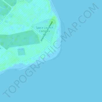
Name: Topografische Karte Cape Canaveral, Höhe, Relief.
Ort: Cape Canaveral, Brevard County, Florida, United States (28.44077 -80.53662 28.46077 -80.51662)
Durchschnittliche Höhe: 1 m
Minimale Höhe: -2 m
Maximale Höhe: 8 m
The hurricane of August 1885, pushed a "wall of water" over the barrier island (elevation, 3.1 m (10 ft)) devastating Cape Canaveral and adjacent areas. The ocean waves flooded the homesteaders and discouraged further settlement in the area. The beach near the lighthouse was severely eroded prompting its relocation 1.6 km (0.99 mi) west inland.
Andere topografische Karten
Klicken Sie auf eine Karte, um ihre Topografie, ihre Höhe und ihr Relief anzuzeigen.
Micco
United States > Florida > Brevard County
Micco, Brevard County, Florida, 32976, United States
Durchschnittliche Höhe: 6 m
Melbourne
United States > Florida > Brevard County > Melbourne
Melbourne, Brevard County, Florida, 32910, United States
Durchschnittliche Höhe: 4 m
Malabar
United States > Florida > Brevard County
Malabar, Brevard County, Florida, 32950, United States
Durchschnittliche Höhe: 7 m
West Melbourne
United States > Florida > Brevard County
West Melbourne, Brevard County, Florida, 32904, United States
Durchschnittliche Höhe: 10 m
Melbourne
United States > Florida > Brevard County > Melbourne
Melbourne, Brevard County, Florida, United States
Durchschnittliche Höhe: 6 m
Melbourne
United States > Florida > Brevard County
Melbourne, Brevard County, Florida, United States
Durchschnittliche Höhe: 6 m