
Topografische Karte Candaba
Interaktive Karte
Klicken Sie auf die Karte, um die Höhe anzuzeigen.
Über diese Karte
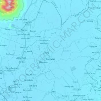
Name: Topografische Karte Candaba, Höhe, Relief.
Ort: Candaba, Pampanga, Central Luzon, Philippines (15.00828 120.78124 15.20970 120.95257)
Durchschnittliche Höhe: 24 m
Minimale Höhe: 0 m
Maximale Höhe: 989 m
Andere topografische Karten
Klicken Sie auf eine Karte, um ihre Topografie, ihre Höhe und ihr Relief anzuzeigen.
Mount Arayat
Philippines > Pampanga > Arayat
Mount Arayat stands in the middle of the flat Central Luzon Plain, consisting of rice paddies and a typical elevation of about 15 to 35 metres (49 to 115 ft) AMSL. The mountain is topped by a circular volcanic crater about 1.2 kilometres (0.75 mi) in diameter, much of which has collapsed on the western and…
Durchschnittliche Höhe: 639 m
Mount Arayat
Philippines > Pampanga > Arayat
Mount Arayat stands in the middle of the flat Central Luzon Plain, consisting of rice paddies and a typical elevation of about 15 to 35 metres MSL. The mountain is topped by a circular volcanic crater about 1.2 kilometres (0.75 mi) in diameter, much of which has collapsed on the western and part of the…
Durchschnittliche Höhe: 639 m