

Spenden
Rüste dich für dein nächstes Abenteuer:
Als Amazon-Partner verdient diese Website an qualifizierten Käufen, ohne zusätzliche Kosten für Sie.
Topografische Karten Cameroon
Klicken Sie auf eine Karte, um ihre Topografie, ihre Höhe und ihr Relief anzuzeigen.


Spenden
Rüste dich für dein nächstes Abenteuer:
Als Amazon-Partner verdient diese Website an qualifizierten Käufen, ohne zusätzliche Kosten für Sie.


Spenden
Rüste dich für dein nächstes Abenteuer:
Als Amazon-Partner verdient diese Website an qualifizierten Käufen, ohne zusätzliche Kosten für Sie.

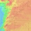
South
The South Region begins at sea level on the coast. The land slowly climbs throughout the Kribi-Douala basin, which averages 300–600 metres in altitude, until it reaches the South Cameroon Plateau with elevations of 500 to 1000 metres above sea level. Rocky promontories on the coast and rolling, tree-covered…
Durchschnittliche Höhe: 517 m

Spenden
Rüste dich für dein nächstes Abenteuer:
Als Amazon-Partner verdient diese Website an qualifizierten Käufen, ohne zusätzliche Kosten für Sie.


Spenden
Rüste dich für dein nächstes Abenteuer:
Als Amazon-Partner verdient diese Website an qualifizierten Käufen, ohne zusätzliche Kosten für Sie.


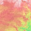
East
Almost the entire territory of the East Region lies on the South Cameroon Plateau that forms the southeastern half of the country. The elevation thus varies between 500 and 1000 metres above sea level except for lower-lying plains of 200 to 500 metres in the extreme southeast centered on the Dja, Boumba,…
Durchschnittliche Höhe: 640 m
Spenden
Rüste dich für dein nächstes Abenteuer:
Als Amazon-Partner verdient diese Website an qualifizierten Käufen, ohne zusätzliche Kosten für Sie.


Spenden
Rüste dich für dein nächstes Abenteuer:
Als Amazon-Partner verdient diese Website an qualifizierten Käufen, ohne zusätzliche Kosten für Sie.


Spenden
Rüste dich für dein nächstes Abenteuer:
Als Amazon-Partner verdient diese Website an qualifizierten Käufen, ohne zusätzliche Kosten für Sie.


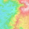
Ndu
Cameroon > Northwest > Donga-Mantung
Ndu is a town and commune in Donga-Mantung, a division in the Northwest Region of Cameroon. It lies at the northeast edge of the Bamenda Grassfields, on the eastern arc of the Ring Road. It is the highest elevation town in Cameroon.
Durchschnittliche Höhe: 1.623 m

Spenden
Rüste dich für dein nächstes Abenteuer:
Als Amazon-Partner verdient diese Website an qualifizierten Käufen, ohne zusätzliche Kosten für Sie.



Spenden
Rüste dich für dein nächstes Abenteuer:
Als Amazon-Partner verdient diese Website an qualifizierten Käufen, ohne zusätzliche Kosten für Sie.

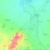
Far-North
These rivers all follow a tropical regime, fluctuating between high water in the wet season (May to September) and low water in the dry season (October to April). At the height of the dry season, many of the waterways disappear completely or else diminish to a mere trickle. The Logone all but disappears during…
Durchschnittliche Höhe: 357 m


Spenden
Rüste dich für dein nächstes Abenteuer:
Als Amazon-Partner verdient diese Website an qualifizierten Käufen, ohne zusätzliche Kosten für Sie.



Spenden
Rüste dich für dein nächstes Abenteuer:
Als Amazon-Partner verdient diese Website an qualifizierten Käufen, ohne zusätzliche Kosten für Sie.


Spenden
Rüste dich für dein nächstes Abenteuer:
Als Amazon-Partner verdient diese Website an qualifizierten Käufen, ohne zusätzliche Kosten für Sie.


Spenden
Rüste dich für dein nächstes Abenteuer:
Als Amazon-Partner verdient diese Website an qualifizierten Käufen, ohne zusätzliche Kosten für Sie.


Spenden
Rüste dich für dein nächstes Abenteuer:
Als Amazon-Partner verdient diese Website an qualifizierten Käufen, ohne zusätzliche Kosten für Sie.


Spenden
Rüste dich für dein nächstes Abenteuer:
Als Amazon-Partner verdient diese Website an qualifizierten Käufen, ohne zusätzliche Kosten für Sie.


Spenden
Rüste dich für dein nächstes Abenteuer:
Als Amazon-Partner verdient diese Website an qualifizierten Käufen, ohne zusätzliche Kosten für Sie.


Spenden
Rüste dich für dein nächstes Abenteuer:
Als Amazon-Partner verdient diese Website an qualifizierten Käufen, ohne zusätzliche Kosten für Sie.


Adamawa Plateau
Cameroon > Adamawa > Vina > Nyambaka
The Adamawa Plateau is the source of many waterways, including the Benue River. The average elevation is about 3,300 feet (1,000 meters), but elevations can reach as high as 8,700 feet (2,700 meters). It is important for its deposits of bauxite. The vegetation is mostly savanna. The endangered toad…
Durchschnittliche Höhe: 1.127 m


Spenden
Rüste dich für dein nächstes Abenteuer:
Als Amazon-Partner verdient diese Website an qualifizierten Käufen, ohne zusätzliche Kosten für Sie.



Spenden
Rüste dich für dein nächstes Abenteuer:
Als Amazon-Partner verdient diese Website an qualifizierten Käufen, ohne zusätzliche Kosten für Sie.


Spenden
Rüste dich für dein nächstes Abenteuer:
Als Amazon-Partner verdient diese Website an qualifizierten Käufen, ohne zusätzliche Kosten für Sie.


Dschang
Due to its high elevation of over 1400 m, Dschang is favoured by relatively cool temperatures and attractive scenery. It is therefore regarded as a mountain tourist resort. Since colonial times, Dschang has been an important agricultural center. Pig production plays a major role.
Durchschnittliche Höhe: 1.360 m
Spenden
Rüste dich für dein nächstes Abenteuer:
Als Amazon-Partner verdient diese Website an qualifizierten Käufen, ohne zusätzliche Kosten für Sie.


Spenden
Rüste dich für dein nächstes Abenteuer:
Als Amazon-Partner verdient diese Website an qualifizierten Käufen, ohne zusätzliche Kosten für Sie.
Mount Cameroon
Cameroon > Southwest > Meme > Mbonge
Mount Cameroon is an active volcano in the Southwest Region of Cameroon next to the city of Buea near the Gulf of Guinea. Mount Cameroon is also known as Cameroon Mountain or Fako (the name of the higher of its two peaks) or by its indigenous name Mongo ma Ndemi ("Mountain of Greatness"). Mount Cameroon is…
Durchschnittliche Höhe: 3.645 m


Spenden
Rüste dich für dein nächstes Abenteuer:
Als Amazon-Partner verdient diese Website an qualifizierten Käufen, ohne zusätzliche Kosten für Sie.


Spenden
Rüste dich für dein nächstes Abenteuer:
Als Amazon-Partner verdient diese Website an qualifizierten Käufen, ohne zusätzliche Kosten für Sie.


Spenden
Rüste dich für dein nächstes Abenteuer:
Als Amazon-Partner verdient diese Website an qualifizierten Käufen, ohne zusätzliche Kosten für Sie.