Geolokalisieren
👉 Easily get elevation data in JSON, GeoTIFF and KML formats using Elevation API
Vielen Dank für die Unterstützung dieser Website ❤️
Spenden

Rüste dich für dein nächstes Abenteuer:

Als Amazon-Partner verdient diese Website an qualifizierten Käufen, ohne zusätzliche Kosten für Sie.

Topografische Karte Palo Verde

Klicken Sie auf die Karte, um die Höhe anzuzeigen.

Über diese Karte

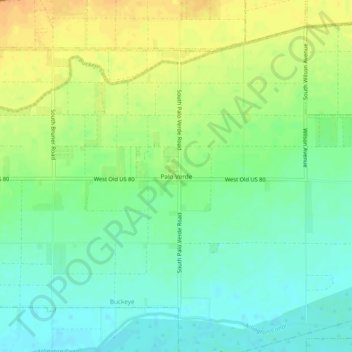
Name: Topografische Karte Palo Verde, Höhe, Relief.

Ort: Palo Verde, Maricopa County, Arizona, 85343, United States (33.32871 -112.69747 33.36871 -112.65747)

Durchschnittliche Höhe: 257 m

Minimale Höhe: 243 m

Maximale Höhe: 273 m

Andere topografische Karten

Klicken Sie auf eine Karte, um ihre Topografie, ihre Höhe und ihr Relief anzuzeigen.

Arlington

United States > Arizona > Maricopa County

Durchschnittliche Höhe: 261 m

Wintersburg

United States > Arizona > Maricopa County

Durchschnittliche Höhe: 305 m

Painted Rock Dam

United States > Arizona > Maricopa County

Durchschnittliche Höhe: 189 m

Sonoran Preserve

United States > Arizona > Maricopa County > Phoenix

Durchschnittliche Höhe: 521 m

Youngtown

United States > Arizona > Maricopa County

Durchschnittliche Höhe: 341 m

Moeur Park

United States > Arizona > Maricopa County > Tempe

Durchschnittliche Höhe: 362 m

Morristown

United States > Arizona > Maricopa County > Morristown

Durchschnittliche Höhe: 609 m

Manistee Ranch Park

United States > Arizona > Maricopa County > Glendale

Durchschnittliche Höhe: 360 m

Wittmann

United States > Arizona > Maricopa County > Wittmann

Durchschnittliche Höhe: 510 m

Anthem

United States > Arizona > Maricopa County > Anthem

Anthem is built on 5,856 acres (9.2 sq mi) at the base of Daisy Mountain and Gavilan Peak. The community's elevation ranges from 1,760 feet to 2,428 feet, with an average elevation of 1,863 feet. Approximately 36 percent of the community is preserved as open space, including 291 acres of open hillside.

Durchschnittliche Höhe: 580 m

Litchfield Park

United States > Arizona > Maricopa County

Durchschnittliche Höhe: 319 m

New River

United States > Arizona > Maricopa County > Phoenix

Durchschnittliche Höhe: 690 m

Tempe Town Lake

United States > Arizona > Maricopa County > Tempe

Durchschnittliche Höhe: 360 m

Saguaro Lake

United States > Arizona > Maricopa County

Durchschnittliche Höhe: 574 m

Sun City

United States > Arizona > Maricopa County > Peoria

Durchschnittliche Höhe: 356 m

Aguila

United States > Arizona > Maricopa County > Aguila

Durchschnittliche Höhe: 664 m

Arizona Falls

United States > Arizona > Maricopa County > Phoenix

Durchschnittliche Höhe: 390 m

Kiwanis Park

United States > Arizona > Maricopa County > Tempe

Durchschnittliche Höhe: 363 m

Bartlett Reservoir

United States > Arizona > Maricopa County

Durchschnittliche Höhe: 720 m

Estrella

United States > Arizona > Maricopa County > Goodyear

Durchschnittliche Höhe: 324 m

Adobe Dam

United States > Arizona > Maricopa County > Phoenix

Durchschnittliche Höhe: 421 m

Desert West Lake

United States > Arizona > Maricopa County > Phoenix

Durchschnittliche Höhe: 330 m

Altitude

United States > Arizona > Maricopa County > Gilbert

Durchschnittliche Höhe: 378 m

Rüste dich für dein nächstes Abenteuer:

🕶️Gletscherbrille Cat 4 - Maximaler UV-Schutz für Touren auf Firn und Eis
🧥Leichte Daunenjacke - Extreme Wärmeleistung bei kleinstem Packmaß
🍳Outdoor Kochset - Leichtes Geschirr aus Aluminium oder Titan
🩹Erste-Hilfe-Set Outdoor - Kompakte Notfallversorgung für Wanderer und Bergsteiger
🥾Wanderschuhe für Damen - Ergonomische Passform und hoher Grip für Wanderwege

Als Amazon-Partner verdient diese Website an qualifizierten Käufen, ohne zusätzliche Kosten für Sie.