

Topografische Karte Baffin Island
Klicken Sie auf die Karte, um die Höhe anzuzeigen.
Baffin Island
The Baffin Mountains run along the northeastern coast of the island and are a part of the Arctic Cordillera. The highest peak is Mount Odin, with an elevation of at least 2,143 m (7,031 ft), although some sources say 2,147 m (7,044 ft). Another peak of note is Mount Asgard, located in Auyuittuq National Park, with an elevation of 2,011 m (6,598 ft). Mount Thor, with an elevation of 1,675 m (5,495 ft), is said to have the greatest purely vertical drop (a sheer cliff face) of any mountain on Earth, at 1,250 m (4,100 ft). Mount Sharat, with an elevation of 422 m (1,385 ft) and a prominence of 67 m (220 ft) is located on Baffin Island. The mountain is named after geologist Sharat Kumar Roy, the chief geology curator in the Field Museum of Natural History, Chicago. Roy, a native of India, studied in India, London, and earned his Ph.D. at the University of Chicago. Shortly after he started at the Field Museum he joined the 1927-1928 Rawson-Macmillan Expedition to Baffin Island and Labrador. This 15-month expedition began in June 1927.
Über diese Karte

Name: Topografische Karte Baffin Island, Höhe, Relief.
Ort: Baffin Island, Canada (61.86201 -90.10667 73.86164 -61.26178)
Durchschnittliche Höhe: 132 m
Minimale Höhe: -2 m
Maximale Höhe: 2.002 m
Andere topografische Karten
Klicken Sie auf eine Karte, um ihre Topografie, ihre Höhe und ihr Relief anzuzeigen.
Toronto
Despite its deep ravines, Toronto is not remarkably hilly, but its elevation does increase steadily away from the lake. Elevation differences range from 76.5 metres (251 ft) above sea level at the Lake Ontario shore to 209 m (686 ft) ASL near the York University grounds in the city's north end at the…
Durchschnittliche Höhe: 113 m
London
Canada > Ontario > London > London
London has a humid continental climate (Köppen Dfb), though due to its downwind location relative to Lake Huron and elevation changes across the city, it is virtually on the Dfa/Dfb (hot summer) boundary favouring the former climate zone to the southwest of the confluence of the South and North Thames Rivers,…
Durchschnittliche Höhe: 268 m
Whistler
Canada > British Columbia > Squamish-Lillooet Regional District > Whistler Resort Municipality > Whistler
Durchschnittliche Höhe: 996 m
Guelph
This region of Ontario has cold winters and warm, humid summers, falling into the Köppen climate classification Dfb zone, with moderately high rainfall and snowfall. It is generally a couple of degrees cooler than lower elevation regions on the Great Lakes shorelines, especially so in winter, the exception…
Durchschnittliche Höhe: 344 m
Banff
Canada > Alberta > Banff > Banff
Banff is a town within Banff National Park in Alberta, Canada. It is located in Alberta's Rockies along the Trans-Canada Highway, approximately 126 km (78 mi) west of Calgary and 58 km (36 mi) east of Lake Louise. At 1,400 to 1,630 m (4,590 to 5,350 ft) above sea level, Banff is the community with the second…
Durchschnittliche Höhe: 1.615 m

Laurentian Mountains
One of Quebec's official regions is called Laurentides. The mountain range runs through four other regions; Capitale-Nationale, Outaouais, Lanaudière, and Mauricie. The elevation generally ranges from around 500 m (1,640 ft) to 1,000 m (3,280 ft) with Mont Raoul-Blanchard being its highest peak, at 1,166 m…
Durchschnittliche Höhe: 348 m




Perth Road Village
Canada > Ontario > Frontenac County > South Frontenac
Durchschnittliche Höhe: 149 m
Signal Hill National Historic Site
Canada > Newfoundland and Labrador > St. John's
Durchschnittliche Höhe: 29 m
Grouse Mountain
Canada > British Columbia > Metro Vancouver Regional District
Grouse Mountain is one of the North Shore Mountains of the Pacific Ranges in the District Municipality of North Vancouver, British Columbia, Canada. With a maximum elevation of over 1,200 m (4,100 feet) at its peak, the mountain is the site of an alpine ski area, Grouse Mountain Resort, which overlooks Greater…
Durchschnittliche Höhe: 968 m


Mundy Park
Canada > British Columbia > Metro Vancouver Regional District > Coquitlam
Durchschnittliche Höhe: 139 m

Lasqueti
Canada > British Columbia > qathet Regional District > Area E (Lasqueti Island) > Lasqueti
Durchschnittliche Höhe: 48 m

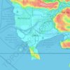
Delta
Canada > British Columbia > Metro Vancouver Regional District > Delta
Durchschnittliche Höhe: 13 m

Onanole
Canada > Manitoba > Division No. 15 > Municipality of Harrison Park
Durchschnittliche Höhe: 627 m


150 Mile House
Canada > British Columbia > Cariboo Regional District > Area F (Horsefly/Likely/150 Mile House)
Durchschnittliche Höhe: 789 m





Dundas
Canada > Ontario > Hamilton > Dundas
Dundas /ˈdʌnˌdæs/ is a community and former town in Hamilton, Ontario, Canada. It is nicknamed the Valley Town because of its topographical location at the bottom of the Niagara Escarpment on the western edge of Lake Ontario. The population has been stable for decades at about twenty thousand, largely…
Durchschnittliche Höhe: 171 m


Burnaby
Canada > British Columbia > Metro Vancouver Regional District > Burnaby
Burnaby occupies 98.60 square kilometres (38.07 sq mi) and is located at the geographic centre of the Metro Vancouver area and home to the Metro Vancouver regional government in Metrotown. Situated between the city of Vancouver on the west and Port Moody, Coquitlam, and New Westminster on the east, Burnaby is…
Durchschnittliche Höhe: 144 m
Nose Hill Park
Names currently associated with topographical features in and near Nose Hill Park reflect the impact of the European newcomers and European trade goods on the Peigan. For example, Spy Hill, the westward extension of Nose Hill, derived its present name from the aboriginal practice of communicating with distant…
Durchschnittliche Höhe: 1.174 m




Mont Saint-Bruno
Canada > Quebec > Urban agglomeration of Longueuil > Saint-Bruno-de-Montarville
Durchschnittliche Höhe: 85 m

Primrose Lake
Canada > Saskatchewan > Unorganized Division No. 18
Primrose Lake has a total surface area of 444 km2 (171 sq mi), 17.7 km2 (6.8 sq mi) of which is in Alberta, and an elevation of 559 metres (1,834 ft). It lies within muskeg and the boreal forest ecozone of Canada. There are several rivers and creeks that flow into the lake with Calder River on the northern…
Durchschnittliche Höhe: 607 m


Elk River
Canada > British Columbia > Regional District of East Kootenay > Fernie
Durchschnittliche Höhe: 1.134 m



Nazko
Canada > British Columbia > Cariboo Regional District > Area I (West Fraser/Nazko)
Durchschnittliche Höhe: 891 m
Burton
Canada > British Columbia > Regional District of Central Kootenay > Area K (The Arrow Lakes)
Durchschnittliche Höhe: 578 m




Abbot Pass Hut
Canada > British Columbia > Area A (Kicking Horse/Kinbasket Lake)
The approach via Lake O'Hara is by far the most popular route into the hut. It is safer and less technical than going in via the Deathtrap or the Fuhrmann Ledges. It involves about 900 metres (3,000 feet) of elevation gain and 3 to 5+ hours from Lake O'Hara to the hut depending on conditions and the strength…
Durchschnittliche Höhe: 2.789 m


Skeleton Lake
Canada > Alberta > Summer Village of Mewatha Beach > Mewatha Beach
Durchschnittliche Höhe: 634 m


Keswick
Canada > Ontario > York Region
Keswick's geographical coordinates are 44.22°N, 79.45°W, and its elevation above sea level is 221m/762 ft. It has a geographical area of 16.25 km² according to Statistics Canada. It is bound on the north by Roches Point, the east by Woodbine Avenue, the south by East Gwillimbury (Ravenshoe Road) and the…
Durchschnittliche Höhe: 228 m



Rideau River Provincial Park
Canada > Ontario > Ottawa > Becketts Landing
Durchschnittliche Höhe: 89 m
Langley Township
Canada > British Columbia > Metro Vancouver Regional District > Township of Langley > Langley Township
Durchschnittliche Höhe: 37 m