
Topografische Karte Seatons Grove
Interaktive Karte
Klicken Sie auf die Karte, um die Höhe anzuzeigen.
Über diese Karte
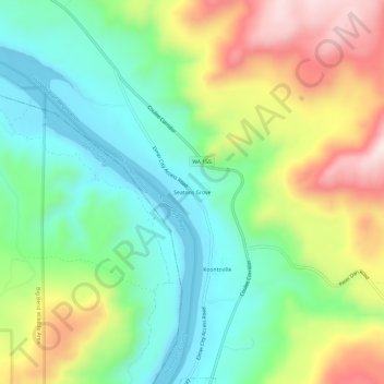
Name: Topografische Karte Seatons Grove, Höhe, Relief.
Durchschnittliche Höhe: 464 m
Minimale Höhe: 286 m
Maximale Höhe: 767 m
Andere topografische Karten
Klicken Sie auf eine Karte, um ihre Topografie, ihre Höhe und ihr Relief anzuzeigen.
Cathedral Peak
United States > Washington > Okanogan County
Cathedral Peak, Okanogan County, Washington, United States
Durchschnittliche Höhe: 2.231 m
Oroville
United States > Washington > Okanogan County > Oroville > Oroville
Oroville, Okanogan County, Washington, 98844-9372, United States
Durchschnittliche Höhe: 475 m
Tonasket
United States > Washington > Okanogan County
Tonasket, Okanogan County, Washington, 98855, United States
Durchschnittliche Höhe: 343 m