
Topografische Karte Subotica
Interaktive Karte
Klicken Sie auf die Karte, um die Höhe anzuzeigen.
Über diese Karte
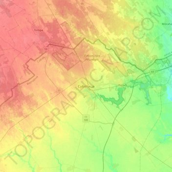
Name: Topografische Karte Subotica, Höhe, Relief.
Durchschnittliche Höhe: 115 m
Minimale Höhe: 87 m
Maximale Höhe: 140 m
Subotica has a warm-summer humid continental climate (Dfb) that is uncommon in Serbia except at higher elevations,
Andere topografische Karten
Klicken Sie auf eine Karte, um ihre Topografie, ihre Höhe und ihr Relief anzuzeigen.
City of Subotica
Serbia > Vojvodina > North Backa Administrative District
City of Subotica, North Backa Administrative District, Vojvodina, Serbia
Durchschnittliche Höhe: 111 m