Geolokalisieren

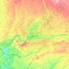
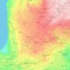
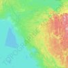
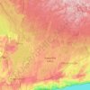
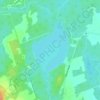
Topografische Karte Halton Region

Klicken Sie auf die Karte, um die Höhe anzuzeigen.

Über diese Karte

Name: Topografische Karte Halton Region, Höhe, Relief.

Ort: Halton Region, Ontario, Canada (43.28628 -80.16113 43.73443 -79.61989)

Durchschnittliche Höhe: 226 m

Minimale Höhe: 70 m

Maximale Höhe: 449 m

Andere topografische Karten

Klicken Sie auf eine Karte, um ihre Topografie, ihre Höhe und ihr Relief anzuzeigen.
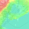
Toronto

Canada > Ontario > Toronto

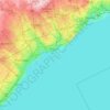
Despite its deep ravines, Toronto is not remarkably hilly, but its elevation does increase steadily away from the lake. Elevation differences range from 76.5 metres (251 ft) above sea level at the Lake Ontario shore to 209 m (686 ft) ASL near the York University grounds in the city's north end at the…

Durchschnittliche Höhe: 113 m
Hamilton

Canada > Ontario > Hamilton

Durchschnittliche Höhe: 181 m

London

Canada > Ontario > London > London

London has a humid continental climate (Köppen Dfb), though due to its downwind location relative to Lake Huron and elevation changes across the city, it is virtually on the Dfa/Dfb (hot summer) boundary favouring the former climate zone to the southwest of the confluence of the South and North Thames Rivers,…

Durchschnittliche Höhe: 268 m
Guelph

Canada > Ontario > Guelph

This region of Ontario has cold winters and warm, humid summers, falling into the Köppen climate classification Dfb zone, with moderately high rainfall and snowfall. It is generally a couple of degrees cooler than lower elevation regions on the Great Lakes shorelines, especially so in winter, the exception…

Durchschnittliche Höhe: 344 m
High Park

Canada > Ontario > Toronto

Durchschnittliche Höhe: 97 m

Kingston

Canada > Ontario > Kingston

Durchschnittliche Höhe: 94 m

Perth Road Village

Canada > Ontario > Frontenac County > South Frontenac

Durchschnittliche Höhe: 149 m
Niagara Escarpment

Canada > Ontario

Durchschnittliche Höhe: 299 m

Cherry Beach

Canada > Ontario > Toronto

Durchschnittliche Höhe: 74 m

Georgetown

Canada > Ontario > Halton Region

Durchschnittliche Höhe: 255 m

Ottawa

Canada > Ontario > Ottawa > Ottawa

Durchschnittliche Höhe: 99 m

Muskrat Lake

Canada > Ontario > Renfrew County > Cobden

Durchschnittliche Höhe: 146 m

Haliburton

Canada > Ontario > Haliburton County > Dysart et al

Durchschnittliche Höhe: 370 m

Cat Lake

Canada > Ontario > Kenora District

Durchschnittliche Höhe: 398 m

Windsor

Canada > Ontario > Windsor

Durchschnittliche Höhe: 185 m

Dundas

Canada > Ontario > Hamilton > Dundas

Dundas /ˈdʌnˌdæs/ is a community and former town in Hamilton, Ontario, Canada. It is nicknamed the Valley Town because of its topographical location at the bottom of the Niagara Escarpment on the western edge of Lake Ontario. The population has been stable for decades at about twenty thousand, largely…

Durchschnittliche Höhe: 171 m
La Cloche Mountains

Canada > Ontario > Sudbury District > Killarney

Durchschnittliche Höhe: 255 m

Perth

Canada > Ontario

Durchschnittliche Höhe: 313 m

Rouge National Urban Park

Canada > Ontario > Toronto

Durchschnittliche Höhe: 143 m

Kaministiquia River

Canada > Ontario > Thunder Bay

Durchschnittliche Höhe: 249 m

Don River

Canada > Ontario > Toronto

Durchschnittliche Höhe: 80 m

Belleville

Canada > Ontario > Belleville

Durchschnittliche Höhe: 107 m

Cambridge

Canada > Ontario > Cambridge

Durchschnittliche Höhe: 295 m

Lindsay

Canada > Ontario > Kawartha Lakes

Durchschnittliche Höhe: 268 m

Port Dover

Canada > Ontario > Norfolk County

Durchschnittliche Höhe: 187 m

Irondale

Canada > Ontario > Haliburton County > Minden Hills

Durchschnittliche Höhe: 331 m

Rideau River Provincial Park

Canada > Ontario > Ottawa > Becketts Landing

Durchschnittliche Höhe: 89 m
Balsam Lake

Canada > Ontario > Kawartha Lakes

Durchschnittliche Höhe: 257 m

Keswick

Canada > Ontario > York Region

Keswick's geographical coordinates are 44.22°N, 79.45°W, and its elevation above sea level is 221m/762 ft. It has a geographical area of 16.25 km² according to Statistics Canada. It is bound on the north by Roches Point, the east by Woodbine Avenue, the south by East Gwillimbury (Ravenshoe Road) and the…

Durchschnittliche Höhe: 228 m
Chelmsford

Canada > Ontario > Sudbury District > Greater Sudbury

Durchschnittliche Höhe: 276 m

Pinehurst Lake

Canada > Ontario

Durchschnittliche Höhe: 295 m

Cloud Lake

Canada > Ontario > Thunder Bay District > Neebing

Durchschnittliche Höhe: 367 m

Rotary Park

Canada > Ontario > Durham Region > Oshawa

Durchschnittliche Höhe: 107 m

Flower Station

Canada > Ontario > Lanark County > Lanark Highlands

Durchschnittliche Höhe: 234 m

Bruce Peninsula

Canada > Ontario > Bruce County

Durchschnittliche Höhe: 186 m

Baltimore

Canada > Ontario > Northumberland County > Hamilton Township

Durchschnittliche Höhe: 176 m

Knox Corners

Canada > Ontario > Simcoe County > Oro-Medonte

Durchschnittliche Höhe: 324 m

Braeside

Canada > Ontario > Renfrew County > McNab/Braeside

Durchschnittliche Höhe: 99 m

Jerseyville

Canada > Ontario > Hamilton

Durchschnittliche Höhe: 223 m

Balderson

Canada > Ontario > Lanark County > Drummond-North Elmsley

Durchschnittliche Höhe: 153 m

Haliburton

Canada > Ontario

Durchschnittliche Höhe: 358 m

Kenora

Canada > Ontario

Durchschnittliche Höhe: 182 m

Peterborough

Canada > Ontario > Peterborough

Peterborough's topography is largely defined by land formations created by the receding Wisconsian glaciers 10,000–15,000 years ago. The South End and Downtown portions of the City sit on what was the bottom of the glacial Lake Peterborough—part of a glacial spillway created when glacial meltwaters from…

Durchschnittliche Höhe: 235 m
Prince Edward

Canada > Ontario

Durchschnittliche Höhe: 118 m

Kawartha Lakes

Canada > Ontario > Kawartha Lakes

Durchschnittliche Höhe: 269 m

Lambton

Canada > Ontario

Durchschnittliche Höhe: 188 m

Parry Sound

Canada > Ontario

Durchschnittliche Höhe: 235 m

Essex

Canada > Ontario

Durchschnittliche Höhe: 193 m

Lac Seul

Canada > Ontario

Durchschnittliche Höhe: 365 m

Harlem Shoal

Canada > Ontario

Durchschnittliche Höhe: 175 m

St. Johns

Canada > Ontario

Durchschnittliche Höhe: 205 m

Quetico Provincial Park

Canada > Ontario

Durchschnittliche Höhe: 432 m

Ohsweken

Canada > Ontario

Durchschnittliche Höhe: 208 m

Sagamok

Canada > Ontario

Durchschnittliche Höhe: 210 m

Docker Lake

Canada > Ontario

Durchschnittliche Höhe: 377 m

Oneida Nation of the Thames

Canada > Ontario

Durchschnittliche Höhe: 224 m

Bigwin Island

Canada > Ontario

Durchschnittliche Höhe: 328 m

Upper Pergeon Lake

Canada > Ontario

Durchschnittliche Höhe: 215 m

York River

Canada > Ontario

Durchschnittliche Höhe: 397 m

Kawartha Lakes (city)

Canada > Ontario

Durchschnittliche Höhe: 274 m

Pelee Island

Canada > Ontario

Durchschnittliche Höhe: 173 m

Quinte West (city)

Canada > Ontario

Durchschnittliche Höhe: 160 m

London

Canada > Ontario

London has a humid continental climate (Köppen Dfb), though due to its downwind location relative to Lake Huron and elevation changes across the city, it is virtually on the Dfa/Dfb (hot summer) boundary favouring the former climate zone to the southwest of the confluence of the South and North Thames Rivers,…

Durchschnittliche Höhe: 269 m

Lambton

Canada > Ontario

Durchschnittliche Höhe: 191 m

Algoma District

Canada > Ontario

Durchschnittliche Höhe: 360 m

London (city)

Canada > Ontario

Durchschnittliche Höhe: 239 m

Golden Lake

Canada > Ontario > Renfrew County > North Algona Wilberforce

Durchschnittliche Höhe: 185 m
Christie Pits Park

Canada > Ontario > Old Toronto

Durchschnittliche Höhe: 117 m

Minden

Canada > Ontario > Haliburton County > Minden Hills

Durchschnittliche Höhe: 320 m

King City

Canada > Ontario > York Region > King

Durchschnittliche Höhe: 302 m

Port Perry

Canada > Ontario > Durham Region > Scugog

Durchschnittliche Höhe: 263 m

Toronto Islands

Canada > Ontario > Toronto

Durchschnittliche Höhe: 123 m

Speed River

Canada > Ontario > Guelph/Eramosa

Durchschnittliche Höhe: 352 m

Frontenac Provincial Park

Canada > Ontario > South Frontenac

Frontenac Provincial Park is located near the town of Sydenham, north of the city of Kingston, Ontario, Canada. The Government of Ontario has classified Frontenac Provincial Park as a natural environment park. The park lies on the Frontenac Axis, a topographic extension of the Canadian Shield, which connects…

Durchschnittliche Höhe: 151 m
Wahwashkesh

Canada > Ontario > Parry Sound District > Whitestone

Durchschnittliche Höhe: 230 m

Almonte

Canada > Ontario > Lanark County > Mississippi Mills

Durchschnittliche Höhe: 137 m

Warkworth

Canada > Ontario > Northumberland County > Trent Hills

Durchschnittliche Höhe: 164 m

Norcan Lake

Canada > Ontario > Frontenac County > North Frontenac

Durchschnittliche Höhe: 229 m

Schomberg

Canada > Ontario > York Region > King

Durchschnittliche Höhe: 243 m

Niagara Escarpment

Canada > Ontario > Hamilton

Durchschnittliche Höhe: 162 m

Simcoe

Canada > Ontario > Norfolk County

Durchschnittliche Höhe: 227 m

Watford

Canada > Ontario > Watford

Durchschnittliche Höhe: 237 m

Iroquois

Canada > Ontario > South Dundas > Iroquois

Durchschnittliche Höhe: 80 m

Barrier Islands

Canada > Ontario > Unorganized Kenora District

Durchschnittliche Höhe: 345 m

Muskeg River

Canada > Ontario > Unorganized Kenora District

Durchschnittliche Höhe: 350 m

The Blue Mountains

Canada > Ontario > Grey County

Durchschnittliche Höhe: 265 m

Maitland River

Canada > Ontario > Huron County > Howick > Gorrie

Durchschnittliche Höhe: 348 m

Pefferlaw

Canada > Ontario > York Region > Georgina

Durchschnittliche Höhe: 231 m

Bonfield

Canada > Ontario > Nipissing District

Durchschnittliche Höhe: 259 m

Conn

Canada > Ontario > Wellington County > Wellington North

Durchschnittliche Höhe: 475 m

Belmont

Canada > Ontario > Elgin County > Central Elgin

Durchschnittliche Höhe: 263 m

Young Lake

Canada > Ontario > Kawartha Lakes

Durchschnittliche Höhe: 231 m

Balsam Lake Provincial Park

Canada > Ontario > Kawartha Lakes

Durchschnittliche Höhe: 270 m

Bolsover

Canada > Ontario > Kawartha Lakes

Durchschnittliche Höhe: 256 m

McFarlane Lake

Canada > Ontario > Sudbury District > Greater Sudbury

Durchschnittliche Höhe: 255 m

Rüste dich für dein nächstes Abenteuer:

🏔️Alpine Ausrüstung - Essentials für Hochgebirgstouren
👖Zipp-Off Wanderhose - Flexibilität bei wechselnden Temperaturen im Gebirge
🛖Hüttenschlafsack Baumwolle - Vorgeschrieben für Übernachtungen auf Alpenvereinshütten
👖Leichte Regenhose - Schutz vor Nässe zum schnellen Überziehen
⌚Outdoor Uhren - Funktionale Uhren für Abenteuer

Als Amazon-Partner verdient diese Website an qualifizierten Käufen, ohne zusätzliche Kosten für Sie.