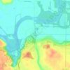
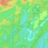
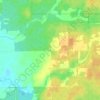
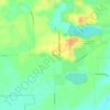
Topografische Karte Rock River
Klicken Sie auf die Karte, um die Höhe anzuzeigen.
Über diese Karte

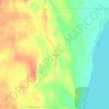
Name: Topografische Karte Rock River, Höhe, Relief.
Ort: Rock River, Wisconsin, 53032, United States (41.45494 -90.61859 43.63582 -88.53901)
Durchschnittliche Höhe: 253 m
Minimale Höhe: 159 m
Maximale Höhe: 494 m
Andere topografische Karten
Klicken Sie auf eine Karte, um ihre Topografie, ihre Höhe und ihr Relief anzuzeigen.
Tower Hill State Park
United States > Wisconsin > Iowa County > Town of Wyoming
Durchschnittliche Höhe: 233 m



Mississippi River
United States > Wisconsin > Grant County > Dubuque
The uppermost lock and dam on the Upper Mississippi River is the Upper St. Anthony Falls Lock and Dam in Minneapolis. Above the dam, the river's elevation is 799 feet (244 m). Below the dam, the river's elevation is 750 feet (230 m). This 49-foot (15 m) drop is the largest of all the Mississippi River locks…
Durchschnittliche Höhe: 203 m
Noyes Park Creek
United States > Wisconsin > Milwaukee County > Milwaukee
Durchschnittliche Höhe: 227 m

Port Washington
United States > Wisconsin > Ozaukee County > Port Washington > Port Washington
Durchschnittliche Höhe: 205 m

Little Prairie
United States > Wisconsin > Walworth County > Little Prairie
Durchschnittliche Höhe: 290 m
Lakeshore State Park
United States > Wisconsin > Milwaukee County > Milwaukee
Durchschnittliche Höhe: 180 m
Governor Thompson State Park
United States > Wisconsin > Marinette County
Durchschnittliche Höhe: 295 m

Glacial Valley Park
United States > Wisconsin > Dane County > Village of Cross Plains
Durchschnittliche Höhe: 287 m
Lead Mine
United States > Wisconsin > Lafayette County > Town of New Diggings
Durchschnittliche Höhe: 264 m
Calumet County Park
United States > Wisconsin > Calumet County > Rockaway Beach
Durchschnittliche Höhe: 257 m

Danbury
United States > Wisconsin > Burnett County
Danbury is located at 46.006N. The longitude is -92.371W. It is in the Central Standard Time Zone. The elevation is 938 feet (286 m) above sea level.
Durchschnittliche Höhe: 287 m

Depere Lock and Dam
United States > Wisconsin > Brown County > De Pere > West De Pere
Durchschnittliche Höhe: 186 m