
Spenden
Rüste dich für dein nächstes Abenteuer:
Als Amazon-Partner verdient diese Website an qualifizierten Käufen, ohne zusätzliche Kosten für Sie.
Topografische Karte Bombay Beach
Klicken Sie auf die Karte, um die Höhe anzuzeigen.
Spenden
Rüste dich für dein nächstes Abenteuer:
Als Amazon-Partner verdient diese Website an qualifizierten Käufen, ohne zusätzliche Kosten für Sie.
Bombay Beach
The derelict "living ghost town" status of Bombay Beach has attracted many photographers, filmmakers, urban explorers, and tourists. The town, as well as others on the shores of the Salton Sea, is one of the lowest settlements in elevation in North America. The local American Legion, Post 801, had 36 members in 2016 and closed down "for a few years" before reopening as a volunteer-run facility.
Spenden
Rüste dich für dein nächstes Abenteuer:
Als Amazon-Partner verdient diese Website an qualifizierten Käufen, ohne zusätzliche Kosten für Sie.
Über diese Karte
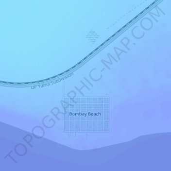
Name: Topografische Karte Bombay Beach, Höhe, Relief.
Ort: Bombay Beach, Imperial County, California, United States (33.34703 -115.74683 33.36523 -115.71887)
Durchschnittliche Höhe: -61 m
Minimale Höhe: -71 m
Maximale Höhe: -29 m
Spenden
Rüste dich für dein nächstes Abenteuer:
Als Amazon-Partner verdient diese Website an qualifizierten Käufen, ohne zusätzliche Kosten für Sie.
Andere topografische Karten
Klicken Sie auf eine Karte, um ihre Topografie, ihre Höhe und ihr Relief anzuzeigen.
Salton City
United States > California > Imperial County
In the 1970s, most of the buildings constructed along the shoreline, including the city's marina were abandoned due to rising sea elevation. In the 1980s, the Imperial Irrigation District took proactive water conservation measures to reduce the flow of unused canal water into the Salton Sea. Throughout the…
Durchschnittliche Höhe: -40 m
Spenden
Rüste dich für dein nächstes Abenteuer:
Als Amazon-Partner verdient diese Website an qualifizierten Käufen, ohne zusätzliche Kosten für Sie.
Spenden
Rüste dich für dein nächstes Abenteuer:
Als Amazon-Partner verdient diese Website an qualifizierten Käufen, ohne zusätzliche Kosten für Sie.
Seeley
United States > California > Imperial County
NAF El Centro, the winter home of the Blue Angels, was built adjacent to Seeley in 1946. In 1964, Interstate 8 was run a mile south of Seeley, marking the lowest elevation on the Interstate Highway System at -52 feet.
Durchschnittliche Höhe: -12 m
Spenden
Rüste dich für dein nächstes Abenteuer:
Als Amazon-Partner verdient diese Website an qualifizierten Käufen, ohne zusätzliche Kosten für Sie.
Dixieland
United States > California > Imperial County
Dixieland is an unincorporated community in Imperial County, California. The name was likely a reference to the Pima cotton fields in the area. It is located 5 miles (8 km) east of Plaster City on County Route S80, at an elevation of 36 feet (11 m) below sea level.
Durchschnittliche Höhe: -3 m
Spenden
Rüste dich für dein nächstes Abenteuer:
Als Amazon-Partner verdient diese Website an qualifizierten Käufen, ohne zusätzliche Kosten für Sie.
Felicity
United States > California > Imperial County
Felicity is an unincorporated community in Imperial County, California. The town was established in 1986 by Jacques-Andre Istel who bought the land in the 1950s and developed it in the 1980s after selling off his parachute business. The town is "Dedicated to Remembrance" and named for Istel's wife Felicia. It…
Durchschnittliche Höhe: 89 m
Spenden
Rüste dich für dein nächstes Abenteuer:
Als Amazon-Partner verdient diese Website an qualifizierten Käufen, ohne zusätzliche Kosten für Sie.
Spenden
Rüste dich für dein nächstes Abenteuer:
Als Amazon-Partner verdient diese Website an qualifizierten Käufen, ohne zusätzliche Kosten für Sie.
Tumco
United States > California > Imperial County
Hedges, later renamed Tumco, is a locale, a ghost town, site of a former mining town, in Imperial County, California. It lies at an elevation of 617 feet / 188 meters along the Tumco Wash in the Cargo Muchacho Mountains. Nearby is the Hedges Cemetery at an elevation of 643 feet (196 meters), at 32°53′04″N…
Durchschnittliche Höhe: 201 m
Spenden
Rüste dich für dein nächstes Abenteuer:
Als Amazon-Partner verdient diese Website an qualifizierten Käufen, ohne zusätzliche Kosten für Sie.
Spenden
Rüste dich für dein nächstes Abenteuer:
Als Amazon-Partner verdient diese Website an qualifizierten Käufen, ohne zusätzliche Kosten für Sie.