
Topografische Karte Harlockstown
Interaktive Karte
Klicken Sie auf die Karte, um die Höhe anzuzeigen.
Über diese Karte
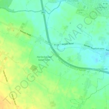
Name: Topografische Karte Harlockstown, Höhe, Relief.
Durchschnittliche Höhe: 73 m
Minimale Höhe: 61 m
Maximale Höhe: 88 m
Andere topografische Karten
Klicken Sie auf eine Karte, um ihre Topografie, ihre Höhe und ihr Relief anzuzeigen.
Bettystown
Bettystown, The Municipal District of Laytown — Bettystown, County Meath, Leinster, A92 AH27, Ireland
Durchschnittliche Höhe: 6 m
Donore
Ireland > County Meath > Donore
Donore, The Municipal District of Laytown — Bettystown, County Meath, Leinster, A92 VW93, Ireland
Durchschnittliche Höhe: 57 m
The Municipal District of Laytown — Bettystown
The Municipal District of Laytown — Bettystown, County Meath, Leinster, Ireland
Durchschnittliche Höhe: 72 m
Boyne
Boyne, Kilcooly ED, The Municipal District of Trim, County Meath, Leinster, C15 X3Y2, Ireland
Durchschnittliche Höhe: 57 m
Maudlin
Maudlin, Trim Rural ED, The Municipal District of Trim, County Meath, Leinster, Ireland
Durchschnittliche Höhe: 61 m
Kells
Ireland > County Meath > Kells
Kells, The Municipal District of Kells, County Meath, Leinster, A82 KD62, Ireland
Durchschnittliche Höhe: 70 m