
Topografische Karte Kaap Oost
Interaktive Karte
Klicken Sie auf die Karte, um die Höhe anzuzeigen.
Über diese Karte
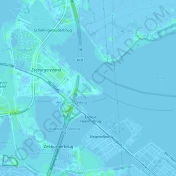
Name: Topografische Karte Kaap Oost, Höhe, Relief.
Ort: Kaap Oost, Amsterdam, Noord-Holland, Nederland (52.36887 4.97470 52.37075 4.97937)
Durchschnittliche Höhe: 0 m
Minimale Höhe: -5 m
Maximale Höhe: 7 m
Andere topografische Karten
Klicken Sie auf eine Karte, um ihre Topografie, ihre Höhe und ihr Relief anzuzeigen.
Amsterdam
Nederland > Noord-Holland > Amsterdam
Amsterdam, Noord-Holland, Nederland, 1012JS, Nederland
Durchschnittliche Höhe: -1 m
Zunderdorp
Nederland > Noord-Holland > Amsterdam
Zunderdorp, Amsterdam, Noord-Holland, Nederland, 1027 AP, Nederland
Durchschnittliche Höhe: -1 m
Schellingwoude
Nederland > Noord-Holland > Amsterdam
Schellingwoude, Amsterdam, Noord-Holland, Nederland, 1023 NH, Nederland
Durchschnittliche Höhe: 1 m
Rembrandtpark
Nederland > Noord-Holland > Amsterdam
Rembrandtpark, West, Amsterdam, Noord-Holland, Nederland
Durchschnittliche Höhe: 4 m
Amsterdam
Nederland > Noord-Holland > Amsterdam
Amsterdam, Noord-Holland, Nederland
Durchschnittliche Höhe: 0 m
Ransdorp
Nederland > Noord-Holland > Amsterdam > Ransdorp
Ransdorp, Amsterdam, Noord-Holland, Nederland, 1028, Nederland
Durchschnittliche Höhe: -1 m