
Topografische Karte Pawłówek
Interaktive Karte
Klicken Sie auf die Karte, um die Höhe anzuzeigen.
Über diese Karte
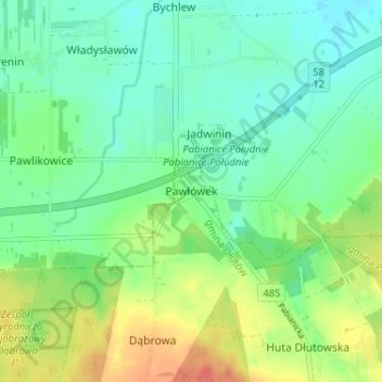
Name: Topografische Karte Pawłówek, Höhe, Relief.
Durchschnittliche Höhe: 198 m
Minimale Höhe: 182 m
Maximale Höhe: 228 m
Andere topografische Karten
Klicken Sie auf eine Karte, um ihre Topografie, ihre Höhe und ihr Relief anzuzeigen.
Pabianice
Poland > Łódzkie Voivodship > Pabianice County
Pabianice, Pabianice County, Łódzkie Voivodship, Poland
Durchschnittliche Höhe: 187 m
Lutomiersk
Poland > Łódzkie Voivodship > Pabianice County
Lutomiersk, gmina Lutomiersk, Pabianice County, Łódzkie Voivodship, 95-083, Poland
Durchschnittliche Höhe: 165 m