
Topografische Karte Monte Lake
Klicken Sie auf die Karte, um die Höhe anzuzeigen.
Über diese Karte
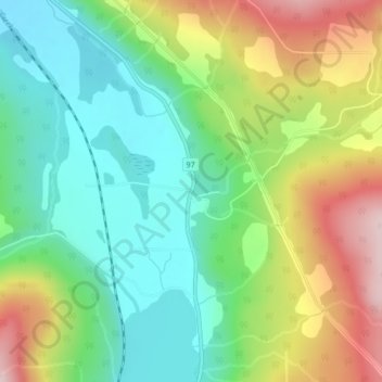
Name: Topografische Karte Monte Lake, Höhe, Relief.
Durchschnittliche Höhe: 790 m
Minimale Höhe: 665 m
Maximale Höhe: 1.003 m
Andere topografische Karten
Klicken Sie auf eine Karte, um ihre Topografie, ihre Höhe und ihr Relief anzuzeigen.
Vancouver
Canada > British Columbia > Metro Vancouver Regional District
Vancouver, British Columbia, is situated on the Burrard Peninsula, bordered by Burrard Inlet to the north and the Fraser River to the south. The city's topography is a blend of flat and hilly terrains, with elevations ranging from sea level to approximately 152 meters (500 feet) above sea level. The North…
Durchschnittliche Höhe: 34 m
Burnaby
Canada > British Columbia > Metro Vancouver Regional District
Burnaby occupies 98.6 square kilometres (38.1 sq mi) and is located at the geographic centre of the Metro Vancouver Regional District. The regional district's government is located in Burnaby's Metrotown area. Situated between the city of Vancouver on the west and Port Moody, Coquitlam, and New Westminster on…
Durchschnittliche Höhe: 59 m
Victoria
Canada > British Columbia > Capital Regional District
Victoria, British Columbia, is situated on the southern tip of Vancouver Island, Canada, and boasts a diverse and varied topography. The city is characterized by rolling hills, rugged coastal cliffs, and lush valleys, providing a striking contrast between mountainous terrain and flatland areas. To the north…
Durchschnittliche Höhe: 17 m
Kelowna
Canada > British Columbia > Regional District of Central Okanagan
Kelowna is classified as a humid continental climate or an inland oceanic climate per the Köppen climate classification system due to its coldest month having an average temperature slightly above −3.0 °C (26.6 °F) and below 0 °C (32 °F), with dry, hot, sunny summers and cool, cloudy winters, and four…
Durchschnittliche Höhe: 704 m
Coquitlam
Canada > British Columbia > Metro Vancouver Regional District
Like much of Metro Vancouver, Coquitlam has an oceanic climate (Köppen climate type Cfb), experiencing mild temperatures and high precipitation; warm, dry summers and cool, wet winters. However, compared to most other cities in the area, precipitation is especially heavy in Coquitlam due to its proximity to…
Durchschnittliche Höhe: 190 m
Vancouver Island
The rain shadow effect of the island's mountains, as well as the mountains of Washington's Olympic Peninsula, creates wide variation in precipitation. The west coast is considerably wetter than the east coast. Average annual precipitation ranges from 6,650 mm (262 in) at Hucuktlis Lake on the west coast…
Durchschnittliche Höhe: 411 m
Okanagan Lake
Canada > British Columbia > Regional District of Central Okanagan > Kelowna
Durchschnittliche Höhe: 1.194 m
Hornby Island
Canada > British Columbia > Comox Valley Regional District > Area A (Baynes Sound)
Durchschnittliche Höhe: 27 m
Quadra Island
Canada > British Columbia > Strathcona Regional District > Area B (Discovery Islands/Mainland Inlets)
Durchschnittliche Höhe: 128 m
Salmon Arm
Canada > British Columbia > Columbia-Shuswap Regional District
Durchschnittliche Höhe: 620 m
Cranbrook
Canada > British Columbia > Regional District of East Kootenay
Durchschnittliche Höhe: 991 m
Revelstoke
Canada > British Columbia > Columbia-Shuswap Regional District
A small ski resort featuring a single short lift has operated on Mount MacKenzie since the 1960s, and snowcat skiing was offered for higher altitudes. A strong movement pushed to expand the entire mountain into a single resort, and construction started in the early 2000s (decade).
Durchschnittliche Höhe: 982 m
West Vancouver
Canada > British Columbia > Metro Vancouver Regional District
Durchschnittliche Höhe: 384 m
New Westminster
Canada > British Columbia > Metro Vancouver Regional District
Durchschnittliche Höhe: 44 m
Port Coquitlam
Canada > British Columbia > Metro Vancouver Regional District
Durchschnittliche Höhe: 29 m
Port Moody
Canada > British Columbia > Metro Vancouver Regional District
Durchschnittliche Höhe: 189 m
Shuswap Lake
Canada > British Columbia > Columbia-Shuswap Regional District > Area F (Scotch Creek/Seymour Arm)
Durchschnittliche Höhe: 1.064 m
Stanley Park
Canada > British Columbia > Metro Vancouver Regional District > Vancouver
Durchschnittliche Höhe: 14 m
Penticton
Canada > British Columbia > Regional District of Okanagan-Similkameen
Penticton is located at the geographical coordinates of 49°29′28″N 119°35′19″W / 49.49111°N 119.58861°W / 49.49111; -119.58861 (Penticton) and covers an area of 42.10 km2 (16.25 sq mi), with a maximum north–south distance of 7 km (4.3 mi) wide between the Okanagan Lake to the north…
Durchschnittliche Höhe: 702 m
Galiano Island
Canada > British Columbia > Capital Regional District > Southern Gulf Islands Electoral Area
Durchschnittliche Höhe: 24 m
Adams Lake
Canada > British Columbia > Thompson-Nicola Regional District > Area O (Lower North Thompson)
According to one account, the lake is 63 kilometres (39 mi) long and 1.6 to 3.2 kilometres (1.0 to 2.0 mi) wide. The surface elevation is 404 metres (1,325 ft) above sea level. The mean depth of 299 metres (981 ft) and maximum depth of 457 metres (1,499 ft) make the second deepest lake in BC (next to Quesnel…
Durchschnittliche Höhe: 1.177 m
Valdes Island
Canada > British Columbia > Cowichan Valley Regional District > Area G (Saltair / Gulf Islands)
Durchschnittliche Höhe: 11 m
Mount Robson Provincial Park
Canada > British Columbia > Regional District of Fraser-Fort George
Durchschnittliche Höhe: 1.837 m
Monashee Provincial Park
Canada > British Columbia > Regional District of North Okanagan > Area E (Cherryville/East Creighton)
Durchschnittliche Höhe: 1.677 m
Comox Glacier
Canada > British Columbia > Alberni-Clayoquot Regional District > Area D (Sproat Lake)
Durchschnittliche Höhe: 1.593 m
Squamish
Canada > British Columbia > Squamish-Lillooet Regional District
Durchschnittliche Höhe: 831 m
Gabriola Island
Canada > British Columbia > Regional District of Nanaimo > Area B (DeCourcy/Gabriola/Mudge)
Gabriola is about 14 kilometres (9 mi) long by 4.2 kilometres (2.6 mi) wide on average with a land area of 57.6 square kilometres (22.2 sq mi). The topography varies from flat sandy beaches at sea level to forested hills rising to 160 metres (525 ft) on Stoney Ridge in the centre of the island.
Durchschnittliche Höhe: 26 m
Gulf Islands National Park Reserve
Canada > British Columbia > Capital Regional District > Southern Gulf Islands Electoral Area
Durchschnittliche Höhe: 57 m
Strathcona Provincial Park
Canada > British Columbia > Strathcona Regional District
Durchschnittliche Höhe: 703 m
Vancouver Island
The rain shadow effect of the island's mountains, as well as the mountains of Washington's Olympic Peninsula, creates wide variation in precipitation. The west coast is considerably wetter than the east coast. Average annual precipitation ranges from 6,650 mm (262 in) at Hucuktlis Lake on the west coast…
Durchschnittliche Höhe: 411 m
Cultus Lake
Canada > British Columbia > Fraser Valley Regional District > Area H (Cultus Lake/Columbia Valley) > Cultus Lake
Durchschnittliche Höhe: 191 m
Mission
Canada > British Columbia > Fraser Valley Regional District
The western part of the district, the Stave Valley, is largely rural and forested but its watercourse is home to what was the largest hydroelectric project in British Columbia until the Bridge River Power Project opened in 1961. It was built by the British Columbia Electric Railway (BCER) to provide power to…
Durchschnittliche Höhe: 345 m
Kimberley
Canada > British Columbia > Regional District of East Kootenay
Kimberley has a continental climate with semi-arid influences and heavy moderation from the nearby mountains which tend to block arctic air masses, and produce a rain shadow. Its fairly high elevation counters this effect slightly, as temperatures are somewhat cooler and the town slightly more rainy than it…
Durchschnittliche Höhe: 1.216 m
Lillooet
Canada > British Columbia > Squamish-Lillooet Regional District
Durchschnittliche Höhe: 736 m
Grand Forks
Canada > British Columbia > Regional District of Kootenay Boundary
Durchschnittliche Höhe: 586 m
Williston Lake
Canada > British Columbia > Peace River Regional District
Durchschnittliche Höhe: 1.191 m
Elk River
Canada > British Columbia > Regional District of East Kootenay > Fernie
Durchschnittliche Höhe: 1.134 m
Prince George
Canada > British Columbia > Regional District of Fraser-Fort George
The area has a humid continental climate (Köppen climate classification Dfb, Trewartha Dclo), but is close to (and once had) a subarctic climate (Dfc) as May and September averages are both close to the 10 °C (50 °F) threshold. Winters are milder than the latitude and elevation might suggest: the January…
Durchschnittliche Höhe: 685 m
Armstrong
Canada > British Columbia > Regional District of North Okanagan
Durchschnittliche Höhe: 377 m
Pemberton
Canada > British Columbia > Squamish-Lillooet Regional District
The climate of Pemberton is very warm and dry in the summer and mild and wet in the winter. Pemberton is an ecologically complex and diverse zone which is referred to as the Coast-Interior Transition zone. Moving from west to east in the direction of the prevailing winds and taking into consideration the…
Durchschnittliche Höhe: 1.005 m
Vanderhoof
Canada > British Columbia > Regional District of Bulkley-Nechako
Durchschnittliche Höhe: 739 m
Invermere
Canada > British Columbia > Regional District of East Kootenay
Durchschnittliche Höhe: 876 m
Terrace
Canada > British Columbia > Regional District of Kitimat-Stikine
Durchschnittliche Höhe: 131 m
Burton (Trout) Creek
Canada > British Columbia > Regional District of Central Kootenay > Area K (The Arrow Lakes)
Durchschnittliche Höhe: 1.659 m
Golden Ears Provincial Park
Canada > British Columbia > Metro Vancouver Regional District
Durchschnittliche Höhe: 794 m
Fraser River
Canada > British Columbia > Chilliwack > Hope > Deroche
Similar to the Columbia River Gorge east of Portland, Oregon, the Fraser exploits a topographic cleft between two mountain ranges separating a more continental climate (in this case, that of the British Columbia Interior) from a milder climate near the coast. When an Arctic high-pressure area moves into the…
Durchschnittliche Höhe: 865 m
East Sooke
Canada > British Columbia > Capital Regional District > Juan de Fuca Electoral Area
Durchschnittliche Höhe: 55 m
West Vancouver—Sunshine Coast—Sea to Sky Country
Durchschnittliche Höhe: 1.021 m
Saturna Island
Canada > British Columbia > Capital Regional District > Southern Gulf Islands Electoral Area
Durchschnittliche Höhe: 34 m
Green Timbers Urban Forest
Canada > British Columbia > Metro Vancouver Regional District > Surrey
Durchschnittliche Höhe: 100 m
Pitt Meadows
Canada > British Columbia > Metro Vancouver Regional District
Durchschnittliche Höhe: 121 m
Rossland
Canada > British Columbia > Regional District of Kootenay Boundary
Durchschnittliche Höhe: 1.128 m
Ross-White Lady Lake Recreation Site
Canada > British Columbia > Regional District of Central Kootenay > Area E (Balfour/Cottonwood Lake)
Durchschnittliche Höhe: 1.858 m
West Kelowna
Canada > British Columbia > Regional District of Central Okanagan
Durchschnittliche Höhe: 649 m
Nelson
Canada > British Columbia > Regional District of Central Kootenay
Durchschnittliche Höhe: 1.325 m
Mayne Island
Canada > British Columbia > Capital Regional District > Southern Gulf Islands Electoral Area > Mayne
Durchschnittliche Höhe: 26 m
Clearwater
Canada > British Columbia > Thompson-Nicola Regional District
Durchschnittliche Höhe: 1.098 m
Township of Langley
Canada > British Columbia > Metro Vancouver Regional District
Durchschnittliche Höhe: 47 m
Peachland
Canada > British Columbia > Regional District of Central Okanagan
Durchschnittliche Höhe: 628 m
Lac la Hache
Canada > British Columbia > Cariboo Regional District > Area G (Lac La Hache/108 Mile Ranch) > Wright
Durchschnittliche Höhe: 918 m
Upper Arrow Lake
Canada > British Columbia > Columbia-Shuswap Regional District > Area B (Shelter Bay/Mica Creek)
Durchschnittliche Höhe: 1.462 m
Otter Point
Canada > British Columbia > Capital Regional District > Juan de Fuca Electoral Area
Durchschnittliche Höhe: 170 m
Garibaldi Lake
Canada > British Columbia > Squamish-Lillooet Regional District > Area D (Elaho/Garibaldi)
All recreational activities in the area are governed by the regulations of Garibaldi Provincial Park. Primary access to the lake is via the 9 km (5.5 mi) long Garibaldi Lake Trail, which gains approximately 920 m (3,020 ft) of elevation from the Rubble Creek Trailhead. There are campgrounds and day-use…
Durchschnittliche Höhe: 1.620 m
Beacon Hill Park
Canada > British Columbia > Capital Regional District > Victoria
Durchschnittliche Höhe: 12 m