
Topografische Karte Rico
Interaktive Karte
Klicken Sie auf die Karte, um die Höhe anzuzeigen.
Über diese Karte
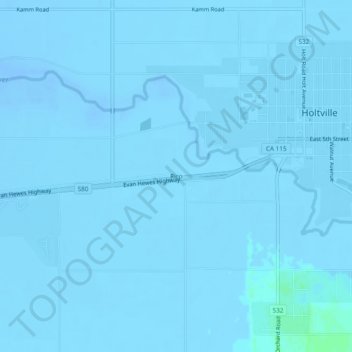
Name: Topografische Karte Rico, Höhe, Relief.
Durchschnittliche Höhe: -7 m
Minimale Höhe: -21 m
Maximale Höhe: 6 m
Andere topografische Karten
Klicken Sie auf eine Karte, um ihre Topografie, ihre Höhe und ihr Relief anzuzeigen.
Heber
United States > California > Imperial County
Heber, Imperial County, California, 92224, United States
Durchschnittliche Höhe: -3 m
Salton Sea
United States > California > Imperial County
Salton Sea, Imperial County, California, United States
Durchschnittliche Höhe: 9 m
Superstition Mountain
United States > California > Imperial County
Superstition Mountain, Imperial County, California, United States
Durchschnittliche Höhe: 130 m
Salton City
United States > California > Imperial County
Salton City, Imperial County, California, 92275, United States
Durchschnittliche Höhe: -35 m
Calipatria
United States > California > Imperial County
Calipatria, Imperial County, California, United States
Durchschnittliche Höhe: -50 m
Niland
United States > California > Imperial County > Niland
Niland, Imperial County, California, United States
Durchschnittliche Höhe: -40 m
Calipatria
United States > California > Imperial County > Calipatria
Calipatria, Imperial County, California, United States
Durchschnittliche Höhe: -53 m
Desert Shores
United States > California > Imperial County
Desert Shores, Imperial County, California, United States
Durchschnittliche Höhe: -58 m
El Centro
United States > California > Imperial County
El Centro, Imperial County, CAL Fire Southern Region, California, 92243, United States
Durchschnittliche Höhe: -10 m